Defensibility check: this is a practical ride-planning piece built from two independent, dated, and now-agreeing sources — I explicitly flag that conditions can change and that readers should check same-day status themselves rather than relying on this post as a live source.
Highway 1 through Big Sur fully reopened on Monday, September 14, 2026, ending more than a month of wildfire-related closures that had cut off one of California’s most scenic coastal drives. If you’ve been waiting to make the run, here’s what actually changed, and what to check before you go.
What happened
Two wildfires forced the closures: the Timber Fire, which first closed a 10-mile stretch of Highway 1 on August 11, and the Plaskett Fire, which erupted August 27 and expanded the closure to 40 miles. Sections reopened gradually over the following weeks, with the final remaining stretch reopening this past Monday — restoring the ability to drive directly from Cambria to Carmel for the first time in over a month.
As of the reopening, containment status was: Plaskett Fire 89% contained (nearly 30,000 acres burned), Timber Fire 39% contained (over 25,000 acres burned). Both fires are still active, just not blocking the road anymore.
Why “open” doesn’t mean “back to normal”
Caltrans explicitly cautioned travelers to remain alert as first responders continue battling the wildfires in the region. More importantly for riders specifically: recently burned hillsides are significantly more prone to flooding and debris flows, which can overwhelm drainage systems and damage the roadway — a real risk that doesn’t disappear just because containment percentages go up or the road reopens.
State and federal officials have already conducted a preliminary debris-flow hazard assessment on the west side of the Timber Fire burn area, with a similar assessment planned for the Plaskett Fire area later this month. That timeline matters: the debris-flow risk assessment for one of the two fire areas isn’t even complete yet.
Before you ride it
This is the actual takeaway: treat this post as a starting point, not a live status check. Conditions on a road through active wildfire-recovery terrain can change without much notice — a closure could return with new rain, a slide, or an active-fire flare-up.
- Check Caltrans QuickMap the day you ride (quickmap.dot.ca.gov) — this is the live, authoritative source for current road status, not any article including this one.
- Check CAL FIRE’s incident page for both the Timber Fire and Plaskett Fire before heading out, especially outside dry-weather windows.
- Expect active recovery work along the route — first responder vehicles, equipment, and possibly reduced-speed sections are reasonable to expect on a road that reopened days ago through an active fire-recovery zone.
- Reconsider timing around rain. Debris flow risk on recently burned slopes is specifically a rain-triggered hazard — if there’s meaningful rain forecast for the area, that’s a real reason to delay, not just caution.
The ride itself
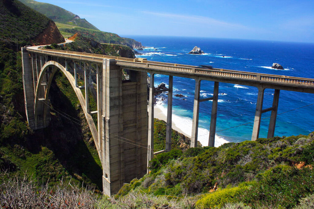
None of this changes what makes the road worth riding once conditions are genuinely good: it’s still Highway 1 through Big Sur, one of the most photographed and genuinely scenic coastal roads in California. The point of this post isn’t to talk anyone out of it — it’s to make sure the decision to go is based on a same-day check, not on “I heard it reopened” from a post written days after the fact.
The bottom line
Highway 1 through Big Sur is open again after more than a month of wildfire closures — genuinely good news for anyone who’s been waiting. But “open” here means “passable,” not “fully recovered.” Recently burned terrain carries real debris-flow risk that a reopening announcement doesn’t resolve. Check Caltrans QuickMap the day you go, not the week before.
Sources: San Francisco Chronicle, “Highway 1 reopens through Big Sur after weeks of wildfire closures” (September 14, 2026); Monterey County official emergency incident page (updated September 18, 2026); CAL FIRE Timber Fire incident page; Caltrans District 5 news releases (August 11 and August 27, 2026).