The alarm goes off at 5:15am. Outside, Bandung is dark and cold in a way the city rarely admits to — it sits at 768 meters above sea level and at that hour, the air has teeth. You pull on a jacket, step outside, and climb onto the back of a stranger’s motorbike.
This is how you get to Tebing Keraton.
Tebing Keraton. The Palace Cliff. The Throne Cliff. The name is older than the Instagram era that made it famous, and it deserves to be understood on its own terms: a sandstone promontory jutting from the edge of a forest reserve in the Dago highlands, 8 kilometers north of central Bandung, overlooking a valley that has been farmed and lived in for centuries. Every morning at dawn, those willing to set an early alarm are rewarded with one of the most complete landscape views in West Java — mountains, mist, forest, farms, and below it all, the invisible presence of a city of two million people sleeping under cloud.
This is not a tourist attraction. It is a place.
The Ride Up
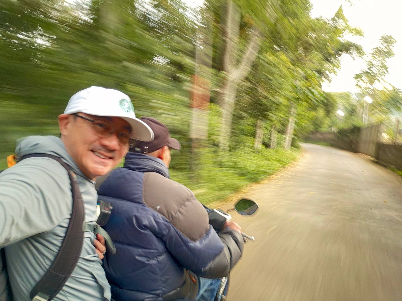
The ojek — Bandung’s motorbike taxi — is not incidental to the experience. It is the experience. The road from the city narrows as it climbs. Storefronts give way to warung. Warung give way to village houses. Village houses give way to bamboo and pine. By the time the trees close fully overhead, the city has ceased to exist. There is only the road, the engine sound, the cool air hitting your face, and the faint smell of forest.
Motion blur smears the trees into green ribbons at the edge of your vision. You are moving toward something. You can feel it.
A Village Still Asleep
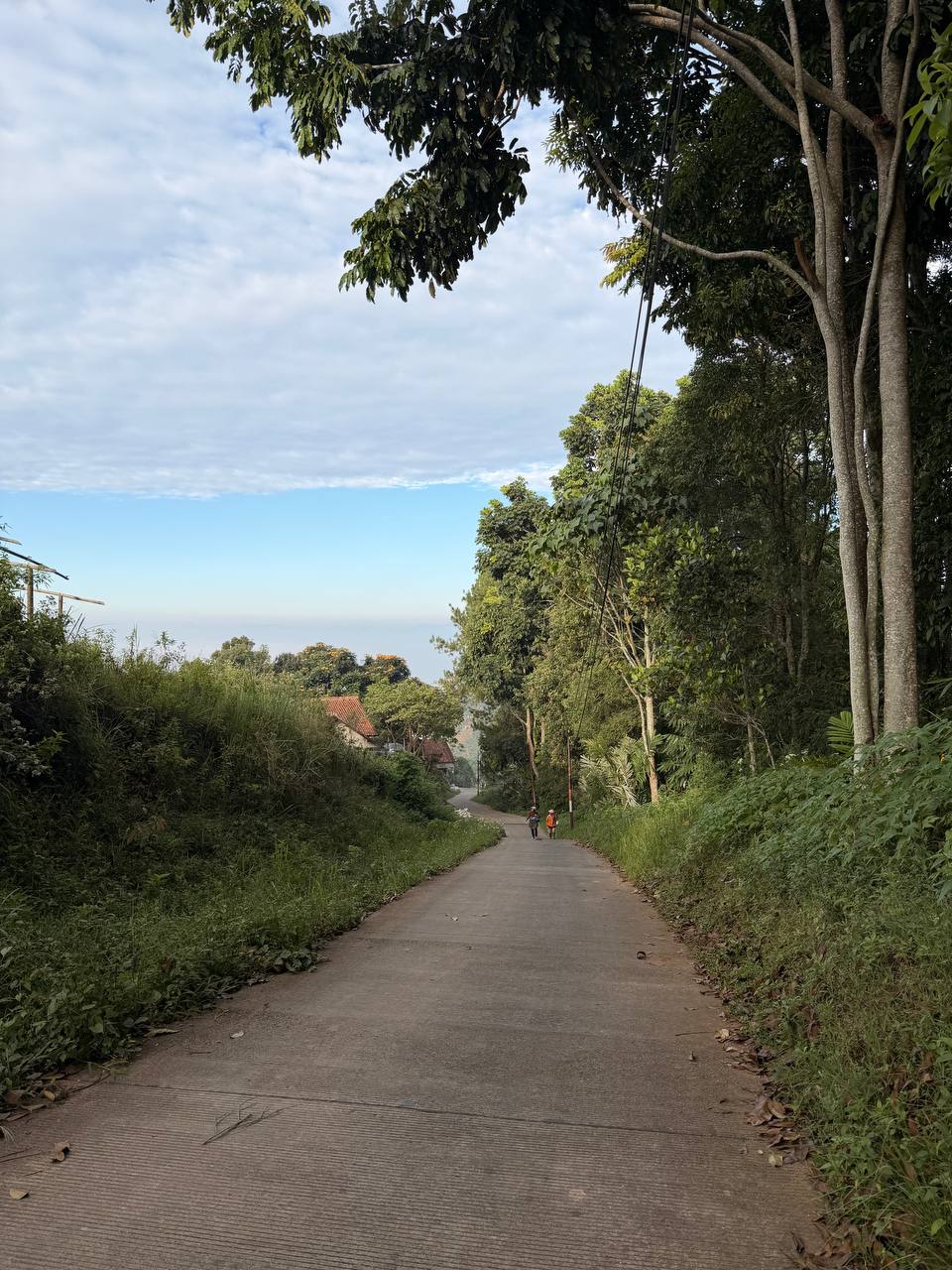
Near the trailhead, the road narrows to a single lane flanked by overhanging trees and sagging power lines. Two figures in the middle distance — locals walking to work, unhurried — are the only other humans visible. One wears orange. They do not look back.
This is the gap between night and day. The hour that belongs to no category. The city crowd went home hours ago; the day-trippers have not yet woken. In this window, briefly, a place like this exists only for itself.
Below the treeline, a kampung drapes itself across the hillside — terracotta tiles and corrugated zinc, banana palms spilling over garden walls, the corrugated geometry of working-class highland life. Beyond the rooftops, the forest rises sharply, a wall of pine and broadleaf that marks the edge of the Tahura Djuanda conservation reserve. Past that edge, the city stops being real.
Entering the Forest
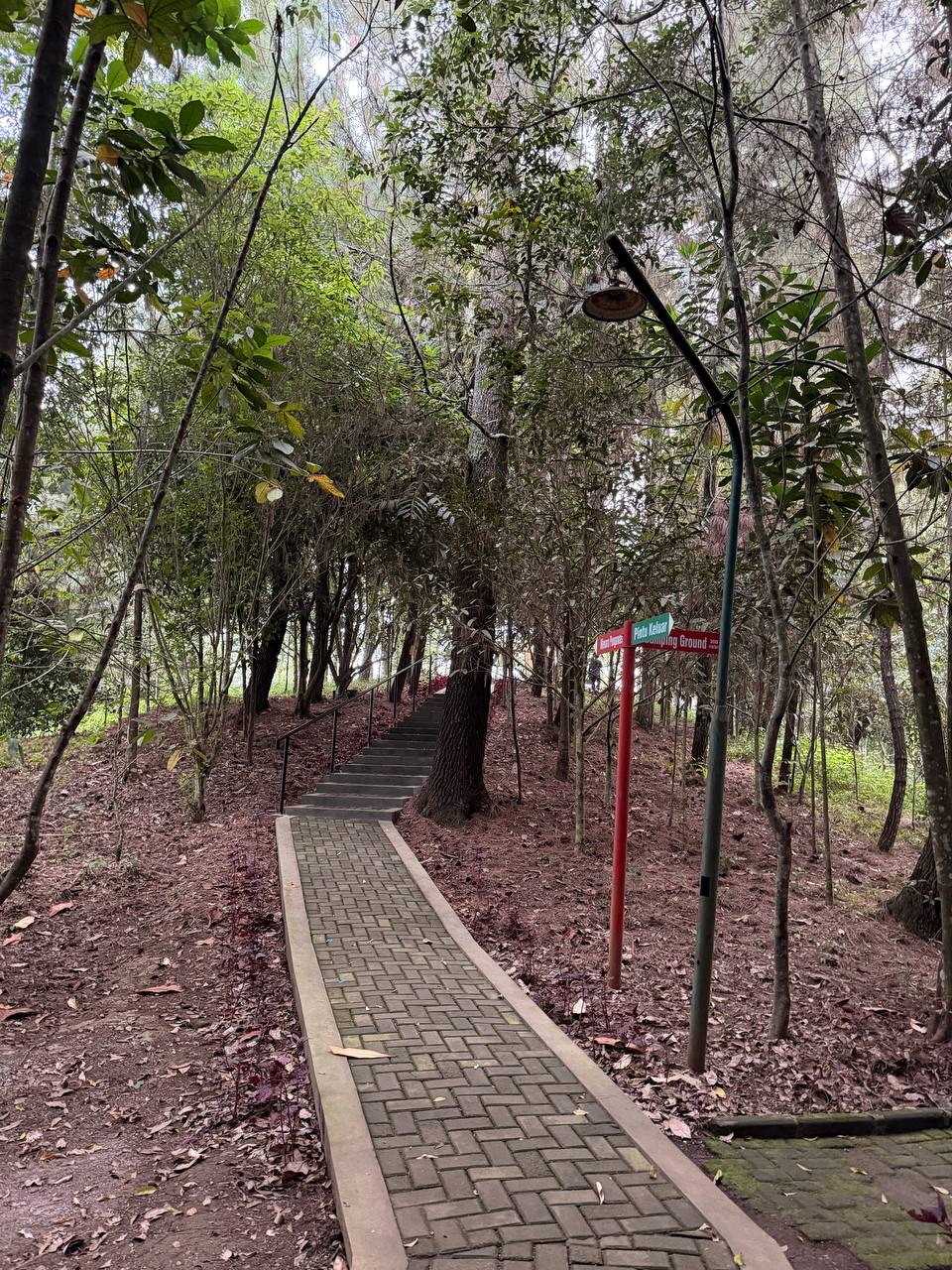
The trail begins with a herringbone brick path that narrows into a stairway and disappears uphill into the canopy. A red signpost at the junction — Pintu Keluar. Camping Ground. — marks the threshold. A lamp post leans slightly, patient. The ground is carpeted in rust-colored fallen pine needles. Everything smells like cool earth and resin.
The walk is short — fifteen to twenty minutes on a paved path through pine and tropical forest. At 5:30am it is completely still. No music, no vendors, no crowd noise. Just the sound of the forest waking up: the first birds calling, the creak of branches overhead, the occasional rustle in the canopy that turns out to be something watching you.
The Residents
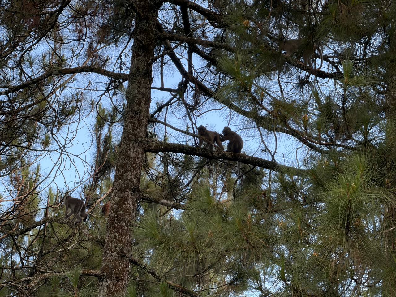
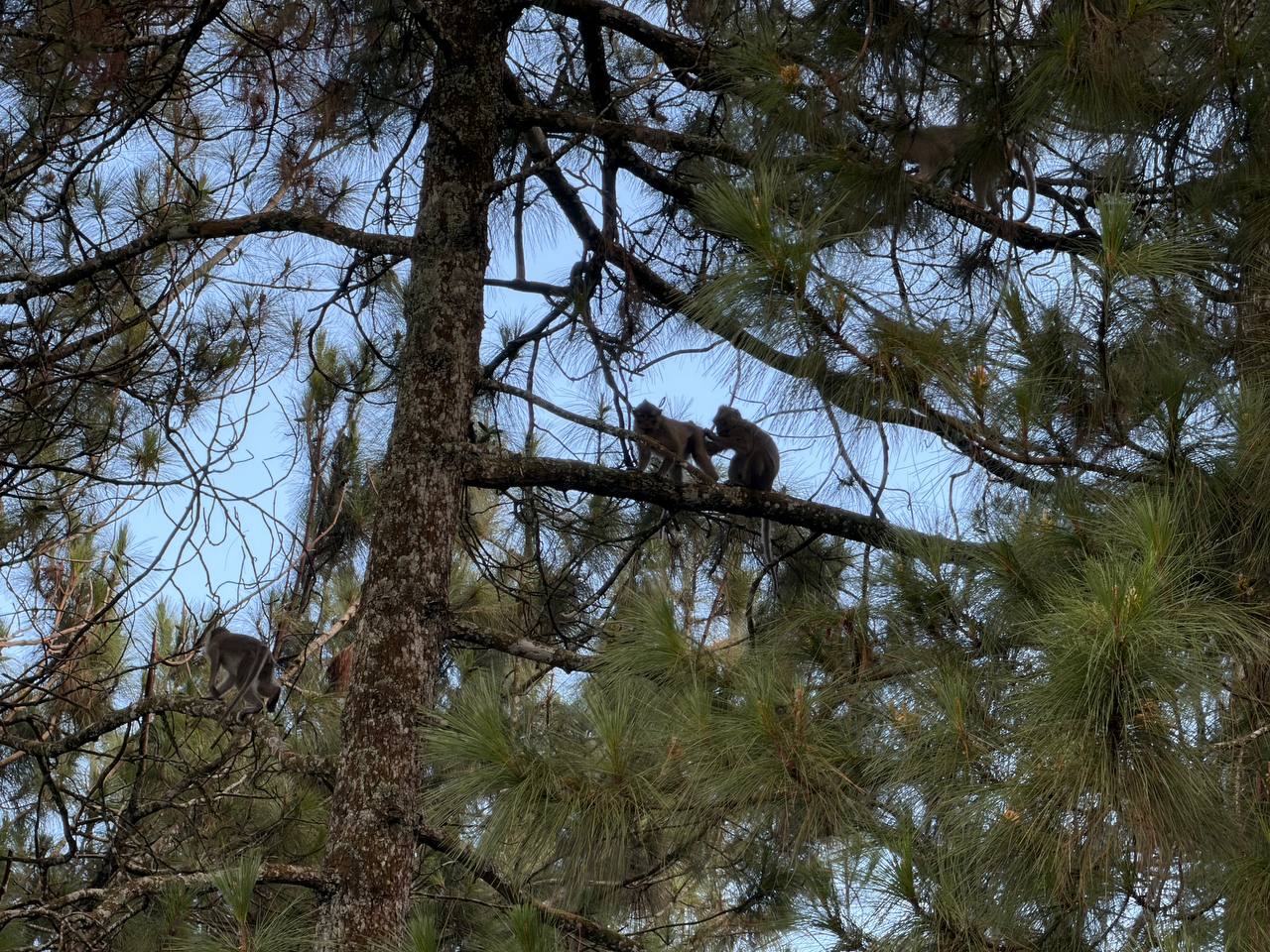
The long-tailed macaques — Macaca fascicularis — own this forest and they have clearly never been told otherwise. They were already active at 5:30am: perched in the upper branches of the pines, grooming each other with the unhurried precision of people who have nowhere to be and no interest in your schedule. Several moved through the canopy directly overhead, performing a kind of aerial social hour with complete indifference to the humans below.
They are not a backdrop. They are prior residents tolerating temporary visitors. The etiquette is simple: keep your bag closed, do not offer food, and don’t try to make eye contact. They will watch you go and return to their business.
This is their morning. You are borrowing it.
The Farmers Were Already Working
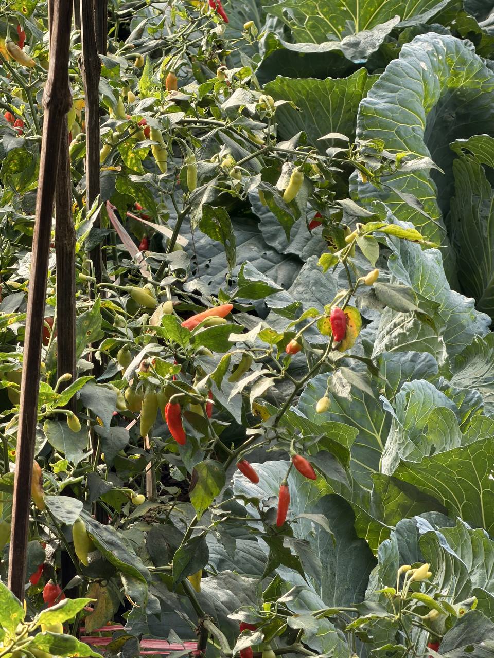
The trail passes through active farmland on the way up. The volcanic soil here is a deep, vivid red-brown — the fertility of centuries, deposited by the mountains that ring this basin. Chili peppers grow in tight rows, their leaves glistening with dew. Cabbage, broccoli seedlings, everything staked and tended. A red dirt path cuts between the rows. At 6am, farmers were already moving through the fields, basket-first, with the efficiency of people who started before you even considered waking up.
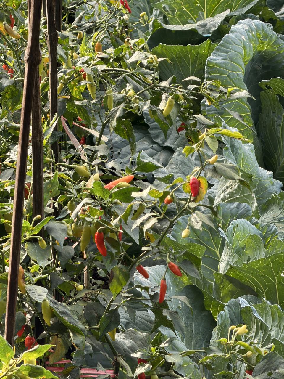
This is what the Bandung highlands actually are. The resorts, the cafés, the Instagram viewpoints — these are the surface layer. Below them, visible only if you come early enough, is an agricultural system that has worked this land continuously for generations. The mist you came to photograph is the same mist that determines these farmers’ harvest. The volcano under your feet is why the soil is so unnervingly red and alive.
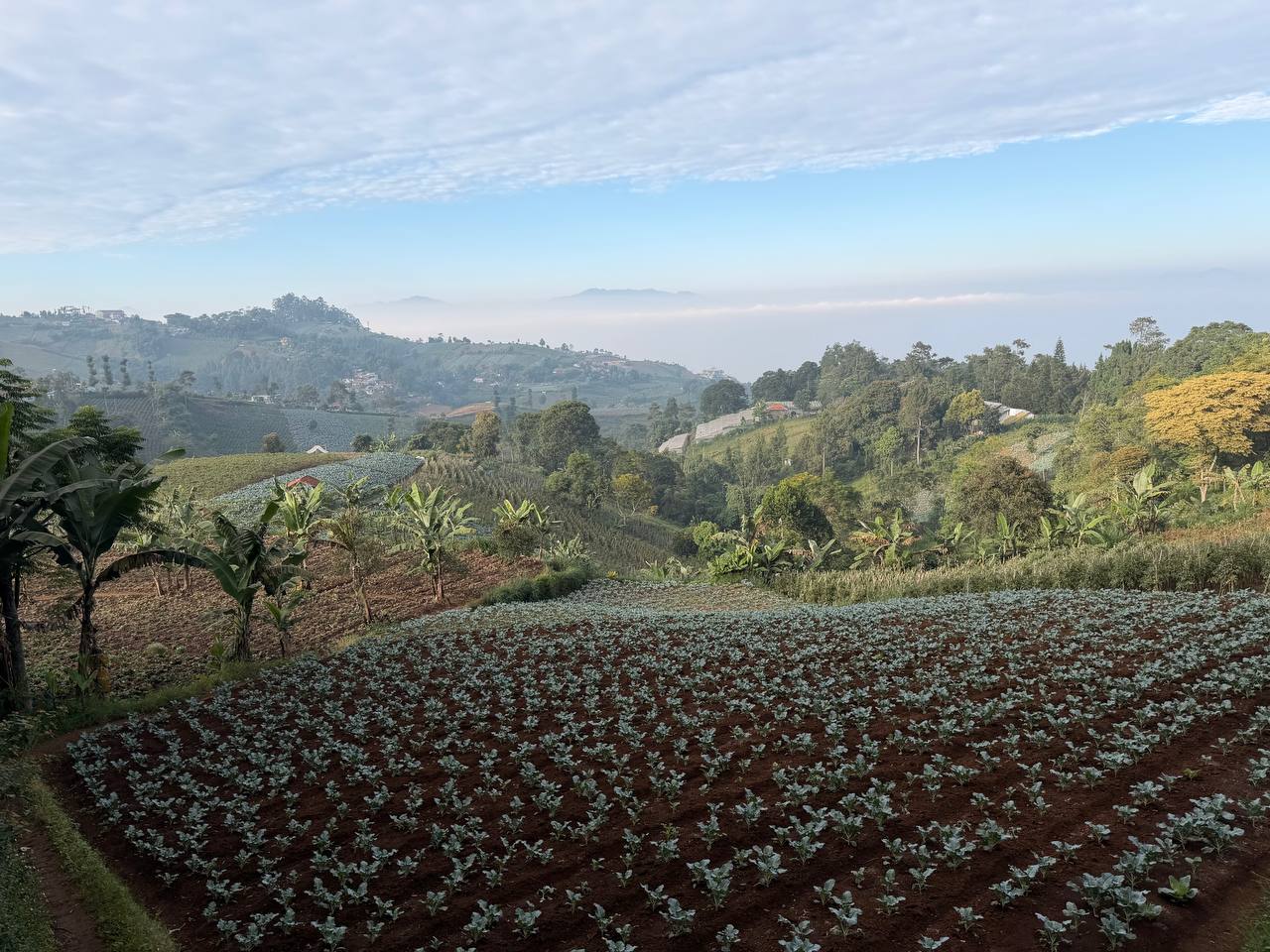
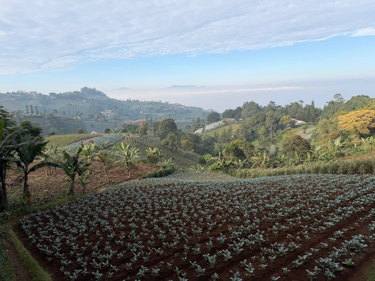
Above the fields, the terraced ridgeline is its own panorama. Neat rows of seedlings recede into a layered backdrop: banana groves, forested slopes, then distant mountains dissolving into morning haze. The light is still soft here — the full sun hasn’t broken over the peaks yet — and the mist sits in the valley bottom like something contained, patient, waiting to be burned away.
The Warung at the Edge of the World
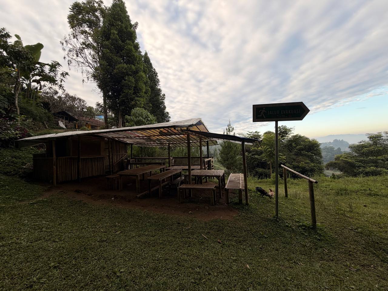
Near the top, where the forest begins to open, a bamboo warung sits in the morning shade. Rough-hewn benches. A corrugated roof catching the first light. Empty at this hour. A rooster picks through the grass beside it with the authority of an animal that has never once been told where it is not allowed to go.
Beside the warung, a green metal sign: JALUR EVAKUASI. Evacuation Route.
It is easy, looking at the soft green hills and morning mist, to forget what this landscape actually is. The Bandung basin sits inside a volcanic caldera. The mountains on the horizon — Tangkuban Perahu to the north, Manglayang to the east — are active. The red soil, the steep ridges, the extraordinary fertility of this place: all of it is the result of an ongoing geological conversation between humans and the forces beneath their feet. The evacuation sign is not bureaucratic caution. It is honest geography.
The Final Approach
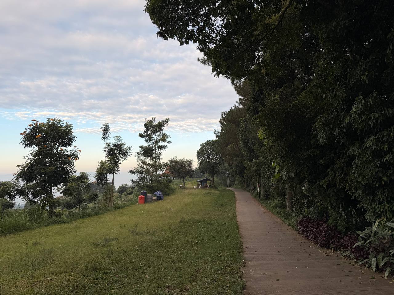
The path curves along the ridge in the final stretch. To the left, the land falls away and the valley opens — still hazy, still pre-dawn blue, full of depth that won’t fully resolve until the light gets stronger. To the right, the treeline. Straight ahead, the path leads somewhere. The first hint that the cliff is close is the quality of the air: it shifts, becomes lighter, carries more horizon in it.
Then the forest ends, and the sky begins.
The Cliff
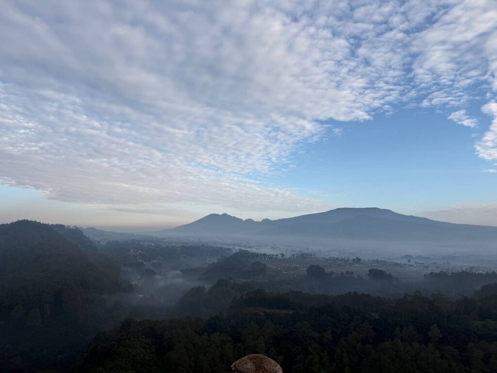
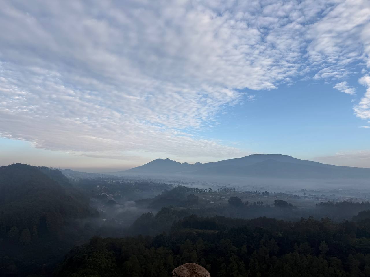
The valley floor is completely gone, replaced by a river of white mist threading between forested ridges. The mountains rise in layered silhouettes from the fog — volcanic peaks in blue-gray, the nearest ridges dark green and detailed, the furthest ranges dissolving into sky. Above it all, an altocumulus sky — a mackerel ceiling of cloud lit from below by the approaching sun, still faintly warm at the edges, still carrying the blue-purple of early morning in the spaces between.
The city of Bandung — two million people, eight kilometers south — is completely invisible. Erased. The cloud layer sits below you, and below the cloud layer, an entire urban civilization is waking up to its routines, unknowing and unimportant at this precise moment.
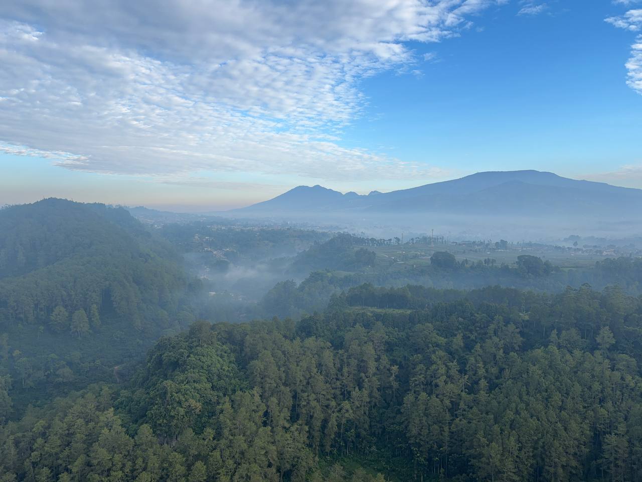
The wider panorama unfolds to the left — a dense carpet of tropical forest cascading down from the ridge, rich with texture, giving way to the valley and then to the mountain ranges stacked behind it, each layer slightly lighter and more remote, each one a geological event frozen in space. A peach warmth glows at the left horizon where the sun is working its way up. To the right, clearer blue. The transition between those two sky colors — from warm to cold — is happening right now, in real time, above a view that has probably looked exactly like this for thousands of years.
At the very edge of the cliff, a single weathered rock juts from the sandstone promontory — the throne that gives this place its name. If you stand behind it, it disappears into the valley below, and for a moment you understand why people called this the Palace Cliff. It is not named for a building. It is named for the sensation of standing at the edge of something vast and feeling, briefly, like you own the view.
By 6:30am, two other visitors had arrived. By 7am, a handful more. But for that first hour — the hour that cost you the alarm — it was essentially private. A cliff, a rock, a valley full of mist, and a sky that was quietly doing something extraordinary while the city below slept.
I stayed for an hour. Watching the mist burn off in slow motion. The valley coming into focus degree by degree. The specific blue of the sky that exists only in the first thirty minutes after the sun clears the mountains — a color that has no name and no equivalent at sea level. Then the light became ordinary, and I walked back down through the farms and the forest and the macaques, and found the ojek waiting, engine off, watching his phone.
The city was waiting too. It always is.
Practical Information
Getting there: Ojek (motorbike taxi) via Grab from central Bandung — about 20–30 minutes depending on traffic and road conditions. The final road is narrow and winding; a motorbike is significantly more practical than a car. Agree on pickup in advance if you want the same driver to wait.
Timing: Leave your hotel by 5:00–5:15am for sunrise. The cliff faces east and the best light — and the best solitude — is in the first 30–45 minutes after the sun clears the mountains. Arrive after 7:30am and you’re in a different, busier experience.
Entrance: Tebing Keraton sits inside the Tahura Djuanda forest reserve. There is a small entrance fee; bring cash as rates occasionally change and card machines are not reliable this deep in the hills.
What to bring: A light jacket — highland mornings at 5:30am are genuinely cold even in June. Comfortable walking shoes. A secured bag if you have anything the macaques might want. Water. A small torch if arriving before 6am.
The monkeys: Do not feed them. Do not make sustained eye contact. Do not underestimate them. They are fast, highly social, and experienced at identifying people who look like they might have food.
The farms: The trail passes through working farmland. Stay on the path, greet farmers if they’re nearby, move through without lingering in the crop rows.
The Bigger Picture
Bandung is easy to underestimate. It presents itself to visitors as a café city — good coffee, creative food, nostalgic Dutch colonial streets. That version of Bandung is real and worth your time. But 8 kilometers north, there is a different version: a volcanic highland system that has been farmed, forested, and lived in for centuries. Macaques and chili farms and evacuation signs and a cliff that drops to a valley floor full of morning mist. A city that disappears when you’re looking at it from above.
Tebing Keraton doesn’t require much. An early alarm. A motorbike. A willingness to be somewhere at 5:30am with no particular agenda beyond showing up and looking at what’s there.
That’s enough. That’s the whole thing.
Tebing Keraton (Palace Cliff) is located inside the Tahura Djuanda conservation forest, approximately 8 km north of central Bandung, West Java, Indonesia. Accessible by ojek from central Bandung. Best visited at sunrise, early dry season (May–August). Elevation approximately 1,200 meters above sea level.
Frequently Asked Questions
What time should I go to Tebing Keraton for sunrise?
Leave your hotel by 5:00–5:15am. The cliff faces east and the best light — and the quietest experience — is in the first 30–45 minutes after sunrise. Arrive early and you may have the viewpoint almost entirely to yourself.
How do I get to Tebing Keraton from Bandung?
The easiest way is an ojek (motorbike taxi) booked via Grab — about 20–30 minutes from central Bandung. A motorbike is far more practical than a car for the narrow, winding final stretch.
Are there monkeys at Tebing Keraton?
Yes — long-tailed macaques (Macaca fascicularis) live throughout the Tahura Djuanda forest and are commonly seen on the trail and in the trees. Do not feed them and keep bags secured.
Is Tebing Keraton inside a national park?
Yes. Tebing Keraton is within the Tahura Djuanda conservation area, which also includes the Dago Pakar and Curug Omas waterfall area. There is an entrance fee payable at the gate.
Is Tebing Keraton worth visiting?
Yes — but specifically early. The sunrise view, the farm trail, the macaques, and the near-total absence of crowds at 5:30am make it one of the most complete single-morning experiences in the Bandung area. Go early, stay an hour, leave before the crowd arrives.